This Hanoi Old Quarter walking guide treats the neighbourhood as a working street grid, not a list of attractions. Shops receive deliveries, families use upper floors, food stalls occupy pavement, and motorbikes move through spaces that may look pedestrian-only. The useful skill is not memorising every historic trade name. It is learning how the lake, Dong Xuan Market, Hang Buom, Ma May, and the eastern gate fit together.
Three routes cover different purposes. Route 1 is the foundation: lake to market, merchant streets, Ma May, and back to the water. Route 2 is a quieter eastern extension around O Quan Chuong. Route 3 is an evening food walk whose stops depend on what is open and suitable when you arrive. Walk one route well; do not force all three into a single hot or wet day.
If you want a guided, tip-based introduction to the same trading-street themes — Ta Hien, O Quan Chuong, markets, and Long Bien approach — reserve the Hanoi Old Quarter Walking Tour. It is free to join with an optional tip afterward; see how tip-based walking tours work. For architecture instead of markets, use the French Quarter walking guide or the French Quarter tour.
How the Old Quarter street grid works
The Old Quarter is compact, but it is not simple. Its commercial streets run into residential alleys, the same name may continue across a junction with a different character, and a route that looks direct on a phone can meet parked scooters, deliveries, temporary work, or a private threshold. Think in anchors rather than trying to memorise every turn: Hoan Kiem Lake to the south, Dong Xuan Market to the north, O Quan Chuong and the dyke to the east.
Historic street names preserve associations with goods and trades, but present-day use is mixed. Hang Bac Street still carries craft and jewellery references; Hang Ma remains associated with paper and ritual goods (place guide deferred until seasonal evidence is stronger); Hang Buom shifts toward food and evening activity. No street is frozen in one guild era. Read what is operating now alongside the historical name. For a short religious pause inside the lanes, see Bach Ma Temple; for the eastern threshold, see O Quan Chuong Gate.
Tube-house form gives the streets much of their rhythm. A narrow frontage can open into a deep plot with courtyards, stairs, workrooms, and family space behind or above the shop. Those interiors are not public simply because a doorway is open. Observe façades, ventilation gaps, balconies, signs, and the movement between ground-floor commerce and upper-floor life without following residents inside.
The grid also changes by sound and pace. Metalwork, food preparation, delivery calls, incense, coffee, and traffic can reveal a street before its sign does. These are useful observations, not a license to claim every smell or sound permanently identifies one block. Businesses and households change; the route remains valuable because it teaches orientation rather than a fixed performance.
Route summary
Route sequence reviewed by the operator on July 23, 2026. Distances and walking times remain approximate and can change with crossings, weather, construction, and stops. Duration includes ordinary observation but excludes a long meal, shopping appointment, or substantial interior visit.
The Google Maps links below are planning aids built from named waypoints. They are not GPS-certified or guaranteed lines. Temporary barriers, one-way traffic, market activity, and the usable side of a pavement can make the written directions and your on-the-ground judgment more important than the blue line.
| Route | Start | End | Distance | Duration | Best for |
|---|---|---|---|---|---|
| 1. Core market loop | East end of Huc Bridge | Same lake area | Approx. 3–3.5 km | 2.5–3.5 hours | First visit, market and merchant streets |
| 2. Eastern gate extension | South-east corner of Dong Xuan Market | Hang Buom at Hang Giay | Approx. 1.5 km | 45–75 minutes | Quieter edge, old gate, street pattern |
| 3. Evening food loop | Hang Buom at Hang Giay | Hoan Kiem Lake via Cau Go | Approx. 1.5–2 km | Around 2 hours | Flexible tastings and evening atmosphere |
Before starting: read the quarter at walking speed
Use Hoan Kiem Lake as the southern anchor. Dong Xuan is north; the Red River dyke is east; streets become broader toward the French Quarter south-east of the lake. Save your accommodation address, download an offline map, and stop beside a shopfront before checking it. Navigation becomes unsafe when a walker slows suddenly in the traffic line.
Wear shoes with grip. Pavement can be uneven, wet from cleaning or rain, occupied by stools, or blocked by parked scooters. Walk single file where space narrows. Cross at signals or marked points when practical, watch turning vehicles, and keep a steady visible pace only when you judge the gap manageable. If a crossing feels beyond your comfort level, walk to a controlled junction.
The best start depends on current weather and your body, not a universal clock. Earlier hours can bring active deliveries and less accumulated heat; evening brings food service and larger crowds. Check the day's forecast and current holiday or event conditions. In heavy rain, thunder, flooding, high heat, or poor visibility, shorten the route or move indoors.
Route 1: core market and merchant-street loop
Start and end: east end of the red Huc Bridge, beside Dinh Tien Hoang. Distance: approximately 3–3.5 kilometres. Duration: 2.5–3.5 hours with a short market look and one drink stop. The loop uses major named streets and returns to the same lake anchor.
An optional visit to Ngoc Son Temple belongs before the street loop. Treat it as a separate interior stop: check current access, ticket information, dress guidance, and worship activity at the entrance. This guide makes no promise about hours or admission.
Planning route only, built from named waypoints. Prefer the turn-by-turn directions and current street conditions; the map line is not guaranteed.
Route 1 turn-by-turn
1. From the bridge entrance, face north and follow Dinh Tien Hoang along the lake edge. At the northern end of the water, continue into Hang Dao.
2. Stay north as Hang Dao becomes Hang Ngang and then Hang Duong. This is the commercial spine toward Dong Xuan Market. Watch for delivery traffic and keep entrances clear.
3. Reach the south frontage of Dong Xuan Market. Decide whether to enter based on crowding, floor conditions, and your interest. A short perimeter look is enough if the interior feels unsuitable.
4. Retrace south on Hang Duong, then turn east onto Hang Ma. Continue to Hang Giay and turn south.
5. At Hang Buom, turn east. This section connects ritual-goods and food streets with the eastern side of the grid. Continue to Ma May and turn south.
6. Pass Ma May Heritage House. Enter only after checking current access and house rules. Otherwise, use the exterior address as an orientation point.
7. At Hang Bac, turn west for the workshop street. Listen and observe without entering private work areas or blocking a shop threshold.
8. At Dinh Liet, turn south. Continue to Cau Go, cross only when safe, and return to the Huc Bridge area on Dinh Tien Hoang.
What to notice on the core loop
Hang Dao, Hang Ngang, and Hang Duong show how the lake connects to the market. The value is in repeated details: narrow plots, goods grouped by street, deliveries negotiated in limited space, and domestic life above commercial ground floors. Historic trade associations survive unevenly, so avoid assuming every present shop continues the street's original craft.
Dong Xuan is an operating market, not a staged cultural stop. Keep out of cart paths, avoid photographing people closely without permission, and step aside before reviewing images. If the floor, smell, or congestion is uncomfortable, walk the perimeter and continue. The route does not depend on entering.
Hang Ma, Hang Buom, Ma May, and Hang Bac each change with time and season. Paper goods, food service, heritage façades, and workshops may be present, but one visit cannot prove a permanent use for every storefront. Notice the street as it is rather than trying to force an old guild story onto a changed business.
Markets change through the day
Market timing is better understood as a sequence than a fixed timetable. Earlier periods tend to show more supply work and deliveries; later morning often mixes wholesale movement with general shopping; afternoon can feel more retail-oriented; evening activity moves toward outdoor food, social streets, and any event arrangement operating that day. Holidays, weather, enforcement, and vendor decisions can alter that pattern.
At Dong Xuan, begin with the exterior and entrances. Watch where handcarts and loaded motorbikes are moving before deciding whether to enter. Inside, keep to the side of narrow aisles, avoid stopping at stair landings, and leave if wet flooring, congestion, or sensory intensity makes the visit unsuitable. A perimeter walk still explains how the market connects to Hang Duong and the eastern feeder streets.
Smaller produce and food clusters around the grid can appear and disappear faster than a landmark. Do not publish a vendor's presence as permanent after one encounter. Look for current turnover and safe standing space, then keep moving when you would obstruct work. The market is most legible when you accept that buying, loading, cleaning, and eating share the same limited ground.
Route 2: eastern gate extension
Start: south-east corner of Dong Xuan Market. End: Hang Buom at Hang Giay, where you can rejoin Route 1 or continue to the evening loop. Distance: approximately 1.5 kilometres. Duration: 45–75 minutes. This is an extension, not a Long Bien Bridge crossing.
1. From the market's south-east corner, take Hang Chieu east. Continue straight until O Quan Chuong Gate marks the old eastern edge.
2. View the gate without standing in the carriageway or obstructing residents and businesses. Read the O Quan Chuong history before or after the walk if you want more context.
3. Turn south onto Dao Duy Tu inside the dyke line. Stay on the usable pavement and treat alleys as residential unless clearly public and open.
4. Turn west onto Hang Buom. Continue to Hang Giay. From here, turn north to return toward the market, or continue west and south through the core grid.
The extension is useful when Route 1 still feels comfortable. Skip it when delivery traffic, heat, rain, or fatigue has reduced your attention. The Long Bien Bridge approach is a separate outing with more exposed roads and should not be improvised as an extra turn.
Planning route only, built from named waypoints. Prefer the written route and current street conditions; the map line is not guaranteed.
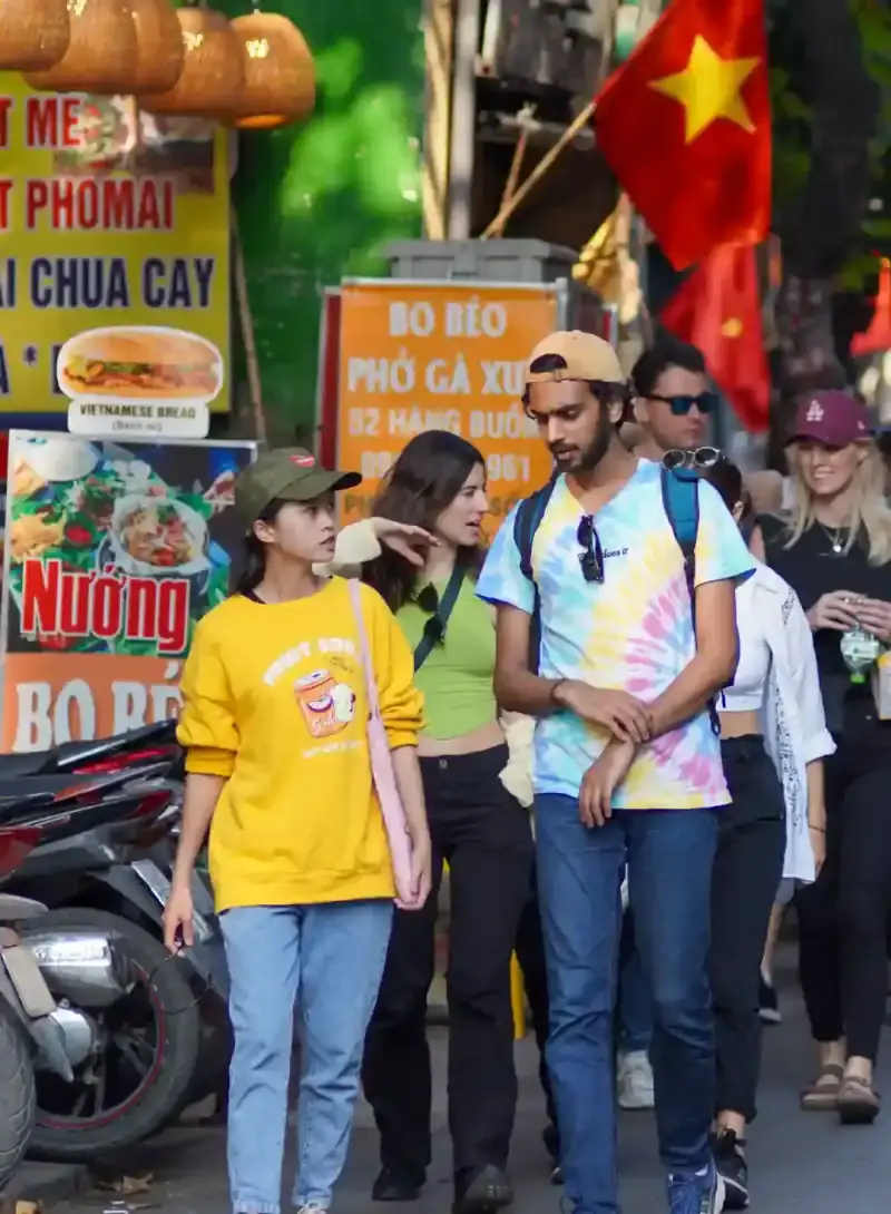
Why the eastern route turns back before Long Bien
The eastern extension is designed to return through the Old Quarter rather than lead walkers onto railway infrastructure. The approach toward Long Bien has wider roads, exposed sections, changing access controls, and traffic conditions that require a separate decision. Seeing the bridge from an approach does not establish permission to enter a trackside or railway area.
If Long Bien is a priority, check current access and safety instructions locally, use a route dedicated to the bridge, and turn back when barriers or staff indicate. Do not infer present access from photographs, old travel posts, or people visible beyond a control point.
Route 3: flexible evening food loop
Start: Hang Buom at Hang Giay. End: Hoan Kiem Lake near Cau Go and Dinh Tien Hoang. Distance: approximately 1.5–2 kilometres. Duration: around two hours with two or three modest stops. This is an independent food route, not the commercial Hanoi Street Food Tour.
1. Walk east along Hang Buom and assess what is actively serving. Choose a stall with visible turnover, a clear ordering process, and food that suits your needs. Do not select solely because a dish appears in an online list.
2. Turn south on Ma May. If you eat here, keep bags and stools out of the pedestrian and scooter line.
3. Continue south, then use Luong Ngoc Quyen to work west toward Ta Hien. Walk through Ta Hien only if the crowd and noise suit you; nearby streets offer an easy bypass.
4. From the Ta Hien area, take Dinh Liet south to Cau Go. A drink or coffee can be the final stop, but current venue availability is not guaranteed.
5. Cross toward Dinh Tien Hoang at a suitable point and finish beside the lake. If weather deteriorates or anyone has consumed alcohol, end the route and arrange a safe ride rather than adding an unfamiliar late-night walk.
Planning route only, built from named waypoints. Prefer the written directions and current street conditions; food stops and the map line can change.
Food choices, allergies, and hygiene
A route cannot guarantee a particular dish. Service hours, sold-out items, holidays, weather, and vendor decisions change. The Hanoi street food guide explains how breakfast, lunch, and evening choices differ; use it for food planning while this article handles street sequence.
For basic hygiene, favour food cooked thoroughly and served hot, busy preparation with visible turnover, clean-looking utensils, and bottled or otherwise reliably treated water. These observations reduce uncertainty but do not certify a stall. If food has been sitting exposed, the preparation area causes concern, or you cannot communicate a medically important restriction, choose another venue.
Peanuts, shellfish, fish sauce, wheat, egg, soy, dairy, and shared equipment can be difficult to identify. A dish that appears free of one ingredient may use it in broth, seasoning, garnish, or frying oil. Travellers with severe allergy or coeliac requirements should not rely on pointing, visual inspection, or a translated phrase alone.
Weather and seasonal walking tactics
Do not rely on a fixed weekend pedestrian-zone schedule, market timetable, temple opening time, ticket price, or Train Street access statement from an evergreen article. Official events, public holidays, safety controls, and local operations can change. Confirm the detail that matters during your stay, then keep an alternative route that does not depend on it.
In hot or humid conditions, begin with the core loop when the forecast is most comfortable, carry water, and decide at Dong Xuan whether to continue. Cutting Route 2 is more sensible than rushing all three routes. Shade moves between narrow streets, but that does not make heat exposure harmless; use a café or suitable indoor stop before fatigue reduces crossing awareness.
In rain, painted road markings, stone, tile, and market floors can become slippery. Avoid low sections where water is accumulating and keep umbrellas close to your body around mirrors, awnings, and other pedestrians. During thunder, flooding, or poor visibility, stop the route and move only when reaching shelter is safe.
Cool, damp weather can feel more tiring than the temperature suggests, especially during long pauses. Carry a light layer and keep it dry. Holiday periods can change food availability, family-business hours, traffic, and religious activity, so confirm current conditions without assuming the same pattern applies every year.
Treat weather as a route decision, not a test of commitment. Route 1 can become a short lake-to-market out-and-back; Route 2 can disappear entirely; Route 3 can end after one suitable meal. A shortened walk that preserves attention is more useful than completing a line while wet, overheated, or distracted.
Accessibility, children, and mixed-pace groups
The Old Quarter should not be described as reliably step-free. Kerbs vary, pavements can be blocked, shop entrances often have steps, market floors may be wet, and walkers are sometimes pushed toward the road edge. Wheelchair users and travelers using mobility aids should ask for a current route-specific assessment rather than relying on the distance alone.
For older travelers or anyone managing pain or fatigue, use the lake as a reset point and make Route 1 modular. Dong Xuan, Ma May, and the return to the water are decision points where the group can shorten the day. Arrange a broad, recognisable pickup street before fatigue becomes urgent; narrow alleys are poor places to summon a vehicle.
With children, reduce both distance and the number of interior stops. Keep adults on the traffic-facing side where practical, cross as a compact group, and agree what to do if the pavement disappears. Markets require close supervision because carts, wet floors, food preparation, and scooters can converge in one aisle.
Mixed-pace groups should name a rear walker and a regrouping landmark before entering dense streets. Do not use “the next corner” as a meeting point when several corners have similar signs. Dong Xuan's exterior, O Quan Chuong, Ma May Heritage House, and the Huc Bridge entrance are more recognisable choices, subject to current access and crowding.
Street etiquette and responsible photography
Pavement is shared working space. Move into single file, keep shop thresholds clear, and do not step over low stools, offerings, food trays, or tools to save a few seconds. A doorway may be a home's entrance as well as a shop opening. If a resident asks you to move, move first and resolve your map afterward.
Ask before making a close portrait. A wider street scene does not remove the need to respect someone who is identifiable and working at close range. Do not photograph worship, private interiors, children, or sensitive railway activity merely because a phone can capture it quickly. A refusal needs no persuasion.
At markets, compose from the side of the flow and lower the camera when carts or customers approach. Never stand in the carriageway, back into traffic, or ask a vendor to repeat an action for an image unless they freely agree. Avoid flash in faces and religious spaces, and follow posted photography restrictions.
Responsible observation often produces better photographs: hands working with permission, repeated façades, signs, stacked goods, changing light, or the relationship between a narrow shop and the street. The route should leave no delayed delivery, blocked scooter, or uncomfortable subject behind it.
Local details worth slowing down for
Look above the product line. Upper balconies, drying clothes, plants, altars glimpsed from public space, and the depth behind a narrow façade show how commerce and home life overlap. Notice without inventing a biography for the household.
Listen at Hang Bac for active craft work, but do not assume every tapping sound proves a centuries-old workshop. Around Hang Ma, observe how paper goods, colour, and ritual commerce change with current demand. Along Hang Buom and Ma May, the balance between daytime trade and evening food activity can shift within the same visit.
Street food clues should remain practical rather than romantic: visible cooking, turnover, seating that does not block movement, and a vendor able to handle the order. Incense, charcoal smoke, coffee, produce, and cleaning water can help you read immediate activity, but none is a permanent location marker.
The most useful detail may be a transition: the moment the market spine becomes a residential lane, the point where the dyke changes traffic sound, or the return of open sky at the lake. Those changes explain the quarter more reliably than a race to photograph every named stop.
Know when you have left the Old Quarter
Ba Dinh, the Ho Chi Minh area, the Temple of Literature, and West Lake are separate walking clusters. They should not be attached to an Old Quarter route simply because every pin appears on one city map. Finish at the lake, then use transport and a separate plan if western Hanoi is your next priority.
Treat a transfer to the western landmarks as a new route with its own weather, access, and transport decisions rather than extending an already full Old Quarter walk.
How to recover if you lose the route
First, stop in a safe recess rather than correcting course while walking. Find the nearest named main street. Hoan Kiem Lake is south of most of these routes; Dong Xuan Market is the northern anchor; the dyke and O Quan Chuong are east. These large references are more useful than guessing through an unmarked alley.
If a map suggests a closed gate or private passage, retrace to the last public street. Do not follow residents through a narrow entrance merely because the line appears to continue. When fatigue or weather makes navigation difficult, move to a broad pickup point and use a reputable taxi or app-booked ride.
Self-guided guide or booked tour?
Use this page when you want control over timing, shopping, photography, and optional interiors. Route 1 gives the essential first walk; Routes 2 and 3 add specific interests without turning the article into a commercial tour page.
Choose the Hanoi Old Quarter Tour when you want a bookable district route with guide interpretation and current meeting instructions. For the French Quarter and civic architecture, use the Free Tour of Hanoi. For ordering support and a guided tasting sequence, compare the Hanoi Street Food Tour.
Sources & last verified
Change note: 29 July 2026 — Added links to Hang Bac, Bach Ma, and O Quan Chuong place guides; route sequences unchanged from 23 July review.
- Free Walking Tours Hanoi operator route review — Three route sequences checked on July 23, 2026.
- Hanoi Department of Culture and Sports: Hoan Kiem Lake and Ngoc Son Temple — Context for the route’s lake anchor.
- Vietnam Tourism: Health and Safety — General travel-health and safety guidance; not a substitute for current local instructions.